


Aerial Drone Photography in Wells, ME
WHAT WE DO
Federal rules cap most drone flights at 400 feet above ground, and the best listing aerials sit well below that. Mile Fly Club Aerials
flies aerial drone photography over Wells, ME
and the New Hampshire Seacoast under a Part 107 certificate, with LAANC authorization filed ahead of any controlled airspace shelf, fully insured, and every frame delivered within 48 hours.
WHERE WE FLY
Coastline, Marsh, And Everything Between The Two
Aerial work along this stretch of coast means reading more than a rooftop. Tidal marsh changes color with the season and the hour. Beach access paths, deeded rights of way, and dune lines matter to buyers and rarely show from the ground. Wooded inland parcels hide their shape entirely until the camera climbs. We check every address against FAA airspace maps before booking, because properties near Portsmouth International at Pease and Sanford Seacoast Regional often sit under controlled shelves that need authorization rather than optimism on the morning of a shoot.
Aerial Photography Services We Offer
Height alone does not sell a property. What sells it is choosing the altitude, angle, and moment that answers a buyer's real question about the lot, the setting, or the road it sits on.
01
Property Overview Aerials
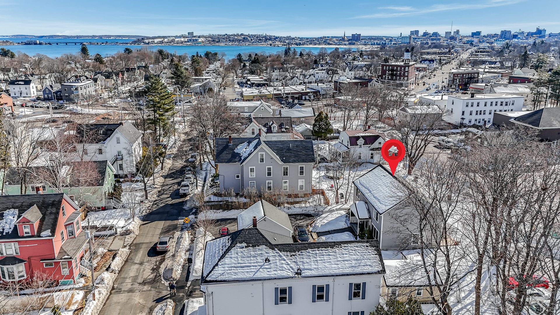
A steady elevated frame places the house on its lot and shows how the parcel actually sits against its neighbors. Buyers finally see the driveway, the outbuildings, the yard, and the boundary hedge together in a single glance.
02
Roof and Structure Documentation
Close overhead passes record shingle condition, flashing, chimneys, skylights, and additions without anyone climbing a ladder. The frames earn their keep before a listing goes live, after a storm season, and whenever a buyer raises a question about the roof.
03
Neighborhood and Location Context
Elevated frames pointing away from the property show what a listing genuinely sits near: the beach path, the marina, conservation land, the town center. Location becomes something a buyer can see for themselves rather than a claim in the description.
04
Water and Waterfront Views
Coastal and pond-front properties get flown when the tide and the light both cooperate. The frames show frontage, dock access, and the honest distance to open water, rather than the flattering angle that a ground-level shot quietly invents.
05
Elevated Twilight Aerials
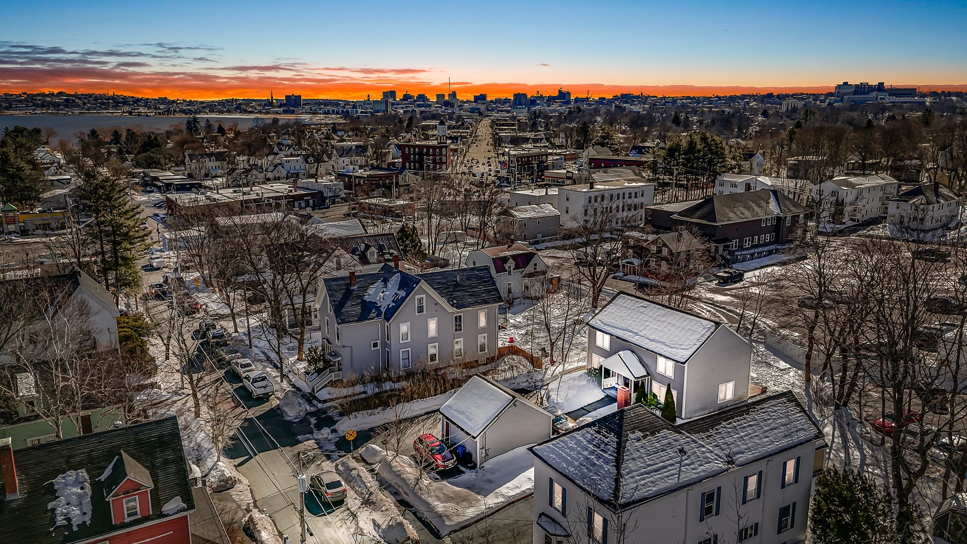
Night operations run with anti-collision lighting visible for three statute miles, exactly as the rules require. Dusk aerials catch a lit house against a deep blue sky, with a shoreline and landscape lighting that read beautifully at that hour.
06
Airspace Clearance and Flight Planning
Every address gets checked against the FAA facility maps first, with LAANC authorization requested wherever it is needed. Complex sites can be coordinated well in advance, so approvals are settled long before anyone is standing in the driveway waiting.
Jane Faber
This is the text area for this paragraph. To change it, simply click and start typing. Once you've added your content, you can customize its design.
Jane Faber
This is the text area for this paragraph. To change it, simply click and start typing. Once you've added your content, you can customize its design.
Jane Faber
This is the text area for this paragraph. To change it, simply click and start typing. Once you've added your content, you can customize its design.
TESTIMONIALS
What Our Customers Say
Why Choose Us for Aerial Drone Photography
Anybody can put a drone in the air. Doing it legally, safely, and at the right moment over a coastal property that sits under controlled airspace is a different job entirely.
01
Legal Flights, Documented Properly
Part 107 certification, aircraft registration, Remote ID broadcast, and insurance are all in place before the day arrives. Sellers and agents are never left holding the risk that follows an unqualified operator flying a camera over an occupied neighborhood.
02
Airspace Checked Before You Book
Addresses are screened against the FAA facility maps at the inquiry stage. Where authorization is required, the request goes in early, so nobody discovers a restriction while standing in the driveway with a listing deadline already locked in.
03
Altitude Chosen For The Property
Not every shot belongs near the ceiling. Low passes flatter a cottage, middle heights suit a subdivision lot, and higher frames serve acreage. Altitude gets picked for the story the property needs to tell, never for the aircraft's capability.
04
Flights Planned Around People Below
Routes stay clear of neighbors, gatherings, and busy roads, with the aircraft kept in sight throughout the flight. Careful operation protects everyone underneath it and keeps the client well away from a complaint they never asked to deal with.
05
Frames That Match Your Ground Set
Aerials are edited to the same color and contrast profile as the interior and exterior photographs. The finished gallery reads as one consistent body of work instead of two separate shoots awkwardly stitched together at the moment of upload.
06
Conditions Judged Honestly
Visibility, cloud base, and wind decide whether an aircraft flies at all. Rescheduling a marginal day costs an afternoon, while flying it anyway costs you the exact frames that were supposed to make the listing worth clicking on.
WHO WE ARE
Certified, Insured, And Accountable For Every Flight
Every flight is a commercial operation under an FAA Part 107 Remote Pilot Certificate, with a registered aircraft broadcasting Remote ID and liability coverage behind it. That matters more than sellers realize, since an uncertificated pilot exposes the agent and owner too. Tim plans each flight around visibility minimums, cloud clearance, wind, and the neighbors below, then flies it himself. If a property sits under restricted airspace, you hear about it at booking. Reach us through the contact page to check your address first.
Frequently Asked Question
How high will the drone actually fly over my property?
Rarely near the legal maximum. Most residential aerials look best between roof height and roughly 150 feet, where the house still dominates the frame. Higher passes get used only when lot size or surrounding context genuinely calls for them.
Can a drone legally fly over my neighbor's property?
Federal airspace rules do not stop a transit, and privacy is governed by state and local law rather than the FAA. In practice, flight paths are planned to keep neighboring homes out of frame and out of the way.
What is LAANC and how long does approval take?
LAANC is the automated system that grants airspace authorization near airports. At pre approved altitudes it often returns clearance within minutes. Requests above the mapped grid altitude get coordinated manually by the FAA and need filing several days ahead.
Do I need permission before drone photos are taken?
Property owner consent is standard practice, and some venues, homeowner associations, or municipalities add conditions of their own. Anything unusual about a site is far better raised at booking than discovered on the morning the aircraft is already unpacked.
What kind of listings benefit most from aerial photos?
Waterfront homes, large lots, acreage, and anything whose value is genuinely tied to its setting. Mile Fly Club Aerials flies these constantly around Wells, Maine, though a townhouse on a small lot usually needs only one context frame.
Can the drone fly if the property is in a no-fly zone?
Some areas allow flight once authorization is granted, and a small number do not permit it at all. Every address gets screened first, and Mile Fly Club Aerials tells clients across Wells, Maine at the inquiry stage rather than afterward.
Does the drone need to stay in sight during the flight?
Yes. Visual line of sight is a core operating rule, and departing from it requires a specific FAA waiver. That shapes how far the aircraft travels from the pilot and how large a parcel gets covered in one flight.
What does Remote ID mean for a drone shoot?
Registered aircraft must broadcast identification and position while flying, which lets authorities identify an operation from the ground. It has been a compliance requirement since 2023, and any professional flying a camera over your property should already meet it.
Why Choose Mile Fly Club Aerials
Creating Powerful Visuals From Every Angle
01
Certified, Insured, and Safety Focused
We are FAA Part 107 certified and properly insured, giving our clients confidence that every commercial drone flight is handled safely and professionally. We carefully plan each project around airspace, weather, lighting, and property conditions to produce dependable results.
02
Complete Ground and Aerial Media
We provide professional real estate photography, drone imagery, aerial video, reels, twilight photos, and specialty content in one convenient service. By capturing properties from multiple perspectives, we help buyers better understand the layout, surroundings, features, and overall value.
03
Personal, Local Service
We work directly with every client and tailor each shoot to the property, project, and intended audience. Because we know the Maine and New Hampshire Seacoast, we understand how to showcase coastal homes, land, rentals, construction projects, and local businesses.
04
Polished and Reliable Results
We deliver clean, professionally edited media designed to attract attention across listings, websites, and social media. Our dependable communication, thoughtful preparation, and timely delivery make it easier for clients to market their properties and businesses confidently.
See The Whole Property, Not Just The Front Door
Ground-level photography answers what a house looks like. Aerial photography answers where it sits, and for coastal Maine that second question often decides the sale. Distance to water, size of the lot, privacy from the road, the shape of the tree line: these are the details buyers guess at until someone shows them properly. Mile Fly Club Aerials brings a certified, insured aircraft and 7 years of local flying to properties throughout Wells, Maine and the wider Seacoast, with airspace handled quietly in the background. Take a minute to send us the address through our contact page and we will confirm what is possible over it.